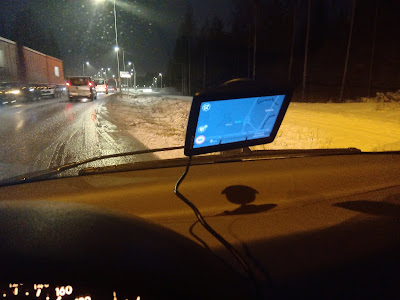
In my home country I use only my smartphone and Google Maps. There is no need for a car navigation system. When going to another country, only a smartphone might not be enough. And especially when the route is planned in advance, the easiest way to reach the daily destination, is a car navigation system. It's not fun to get lost on a road trip!
The problem with having only a smartphone is that the smartphone depends on internet connectivity and battery power.
Some important features for navigation system:
- Route planning and way points
- To get you to the destination
- Traffic updates
- Offline maps
There are navigation systems with more features than others. We have a quite basic TomTom and will use smartphones too on our road trip. TomTom has been travelling with us in Estonia, Great Britain, Sweden and Denmark. And it has usually taken us to our destinations. Sometimes with the help of smartphones if the GPS signal has been lost.
There are features in this one, that could useful:
There are features in this one, that could useful:
- accurate traffic information (routes can be planned around traffic)
- Lifetime World Maps (with road changes and revised speed limits updates)
- Smartphone Messages
Another nice one could be:
Garmin DriveSmart
This one has:
Garmin DriveSmart
This one has:
- Driver alerts for dangerous curves, speed changes, railroad crossings, school zones, speed cameras, fatigue warning and more
- Live parking information for on and off street parking at your destination.
Well, our old TomTom will be just fine.
 |
| TomTom on the road |
 |
| Driving home today. |
The 10 Best Car GPS Navigation Systems 2020
Best car GPS 2020; 13 devices for road trips and daily commutes


